Siesta Key, Florida, is one of those enchanting places where the sun, sand, and sea seem to have conspired to create paradise on Earth. Nestled on the Gulf Coast of Florida, this barrier island is famous for its stunning beaches, lively atmosphere, and charming local culture. If you’re planning a trip or simply curious about this coastal gem, understanding the Siesta Key, Florida, map is crucial for a smooth and enjoyable experience.
What Makes Siesta Key So Special?
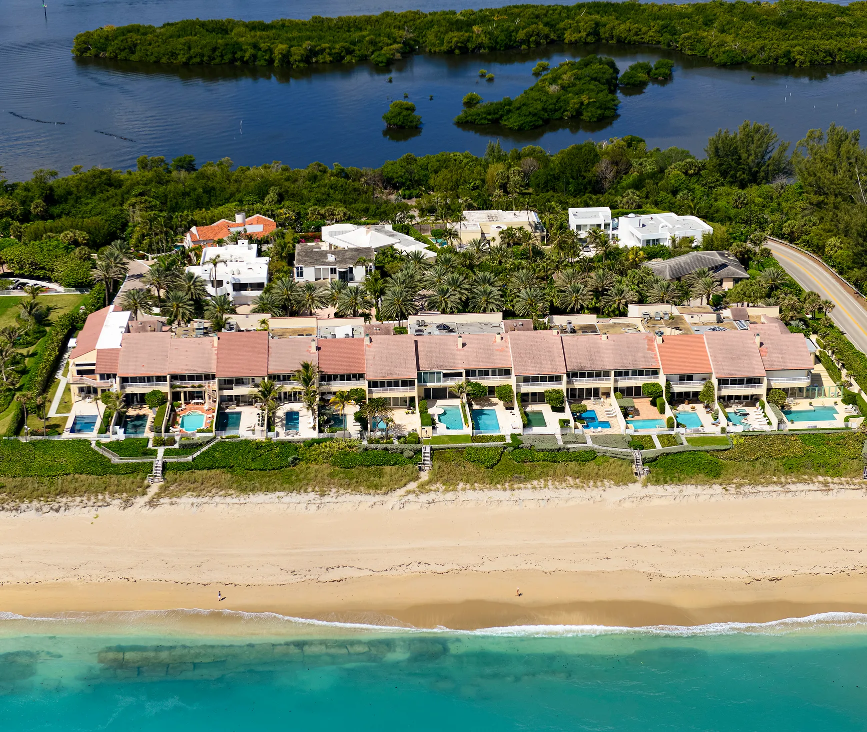
Siesta Key is renowned for its beautiful white sand beaches that feel like walking on powdered sugar. The sand here is unique because it’s made of 99% pure quartz, which gives it that soft, cool feel even on the hottest days. Beyond the beaches, Siesta Key boasts a vibrant community with great restaurants, shops, and fun activities for everyone. Whether you’re into water sports, nature walks, or simply lounging in the sun, Siesta Key has something to offer. Also read Siesta Key, Florida A Complete Guide with Map Insights
Exploring the Siesta Key, Florida Map: A Traveler’s Guide
When you first look at a Siesta Key, Florida, map, you might notice the island’s compact size. Despite being small, it’s packed with diverse attractions and neighborhoods. Understanding the layout of Siesta Key is essential for navigating your way around and making the most of your visit. Let’s break down the key areas and landmarks that you’ll find on the map.
Siesta Beach The Heart of the Island
Siesta Beach is undoubtedly the star attraction on the island. Located on the western side of Siesta Key, this beach stretches for miles, offering plenty of space for sunbathing, swimming, and beach games. The map highlights the beach access points, parking areas, and facilities like restrooms and picnic areas. When you’re at Siesta Beach, you’ll find that the map helps you locate amenities and plan your day.
Crescent Beach A Hidden Gem
Just south of Siesta Beach is Crescent Beach, named for its crescent-shaped shoreline. This area is a bit quieter compared to the more popular Siesta Beach, making it perfect for a more relaxed experience. On the Siesta Key, Florida, map, Crescent Beach is marked to show you the best access points and parking options. It’s a great spot for snorkeling and finding seashells.
Turtle Beach A Nature Lover’s Paradise
Further south on the island is Turtle Beach. This area is known for its natural beauty and less crowded atmosphere. The map will guide you to the various access points and highlight the amenities available, such as fishing spots and picnic areas. Turtle Beach is also famous for being a nesting site for sea turtles, so you might get lucky and spot some turtle activity during the nesting season.
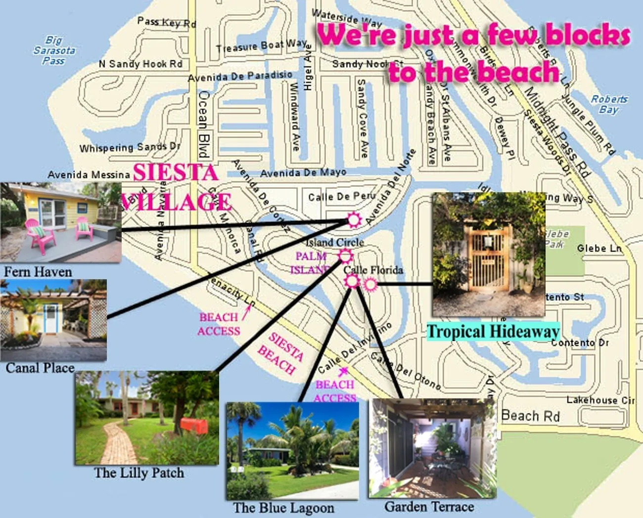
Siesta Key Village The Social Hub
Siesta Key Village is the bustling heart of the island, where you’ll find a wide range of shops, restaurants, and entertainment options. On the map, Siesta Key Village is prominently marked to help you navigate through the various shops and eateries. This area is perfect for evening strolls, dining out, and experiencing the local nightlife.
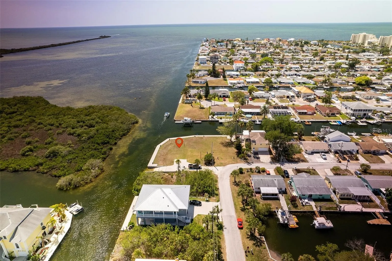
Midnight Pass The Scenic Waterway
Midnight Pass is a picturesque waterway that separates Siesta Key from the mainland. It’s shown clearly on the map and is a popular spot for boating and fishing. The pass offers beautiful views of the water and is a great place to watch the sunset. The map will also indicate the boat ramps and fishing spots available in this area.
Using the Siesta Key, Florida Map for Outdoor Adventures
Siesta Key isn’t just about beaches; it’s also a fantastic place for outdoor activities. The map is an invaluable tool for finding the best spots for your adventures. Here’s how you can use it to enhance your outdoor experiences:
Biking and Walking Trails
Siesta Key has several biking and walking trails that allow you to explore the island at a leisurely pace. The map will show you the routes and help you find trailheads. Whether you’re taking a short bike ride or a long walk, the map will guide you through the scenic spots and ensure you don’t miss out on any hidden gems.
Kayaking and Paddleboarding
The calm waters around Siesta Key are perfect for kayaking and paddleboarding. The map will highlight the best launch points and rental locations. You can paddle through the mangroves, explore the bay, and even spot some local wildlife. The map helps you find the ideal spots to start your water adventures.
Fishing Spots
Fishing enthusiasts will find plenty of opportunities around Siesta Key. The map will point out the best fishing spots, including piers and dock areas. Whether you’re fishing from the shore or heading out on a boat, the map will guide you to where you’re most likely to catch some fish.
Nature Reserves and Parks
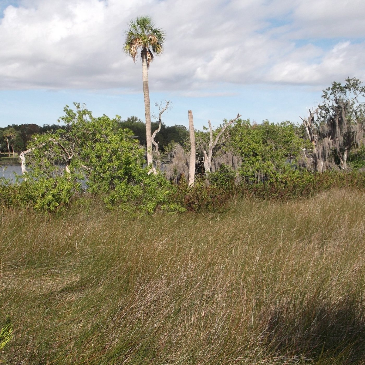
Siesta Key is home to several nature reserves and parks, offering a chance to experience Florida’s natural beauty. The map will show you the locations of these parks and the trails within them. You can explore the local flora and fauna, enjoy a picnic, or simply soak in the peaceful surroundings.
Tips for Navigating the Siesta Key, Florida Map
While the Siesta Key, Florida, map is a fantastic resource, a few tips can help you make the most of it:
Check for Updates
Maps can change over time due to new developments or changes in local regulations. Before your trip, make sure you have the latest version of the map. Online maps or apps can provide real-time updates and additional information.
Use GPS and Online Resources
While the physical map is handy, using GPS and online resources can enhance your navigation experience. Many apps offer interactive maps that provide live traffic updates, points of interest, and user reviews.
Ask for Local Advice
When you arrive on Siesta Key, don’t hesitate to ask locals for recommendations. They can provide valuable insights and tips that might not be on the map. Locals often know the best spots for food, fun, and hidden treasures.
Plan Your Route
Before heading out, plan your route based on the map. Decide which areas you want to explore and how you’ll get there. This planning will help you make the most of your time on the island and ensure you don’t miss any key attractions.
Conclusion
Siesta Key, Florida, is a place where every day feels like a vacation. With its stunning beaches, lively village, and numerous outdoor activities, it’s a destination that offers something for everyone. By understanding and using the Siesta Key, Florida, map, you’ll be well-equipped to explore the island and create unforgettable memories.
From the famous white sands of Siesta Beach to the tranquil waters of Midnight Pass, the map helps you navigate through all that this beautiful island has to offer. So grab your map, pack your sunscreen, and get ready to discover the many wonders of Siesta Key. Whether you’re a first-time visitor or a returning traveler, this guide will ensure you make the most of your time in this tropical paradise. Enjoy your adventure and have a fantastic time on Siesta Key!